
Reports of outdoor meetings 2025.
Rhymney Railway, Ogilvie to Bargoed on Saturday, 19th July.

On a day perfect for walking - pleasantly warm but with a cloud cover and no breeze- five walkers gathered at Bargoed bus station on 19th July for our fist walk of the season along the Bargoed Rhymney valley. A departure of 12.06 was timed to enjoy lunch in the Parc Cwm Darran visitor centre before starting our walk down the valley, thus avoiding the more arduous walk against the gradient where stretches are as severe as 1 in 40.

Had we driven from Bargoed to Parc Cwm Darran it would have taken us around 12 minutes, but the bus took 30 on account of its detour up the east side of the Rhymney valley through Aberbargoed and New Tradegar, then back down the west side through Tir Phil and Brithdir. The detour enabled us to check on electrification progress at Tir Phil and Brithdir where masts are evident in preparation for arms and wires. That is one of the joys of bus travel, wandering off the beaten track and passing through communities you wouldn't otherwise see.

Parc Cwm Darran, an attractive expanse of parkland dominated by a man-made lake, was once the site of Ogilvie colliery. This colliery came late to the South Wales coal scene, being sunk by the Powell Duffryn Steam Coal Company in 1923. Production ceased in 1975, and this traffic was the reason for a single track being maintained down the valley until that date.

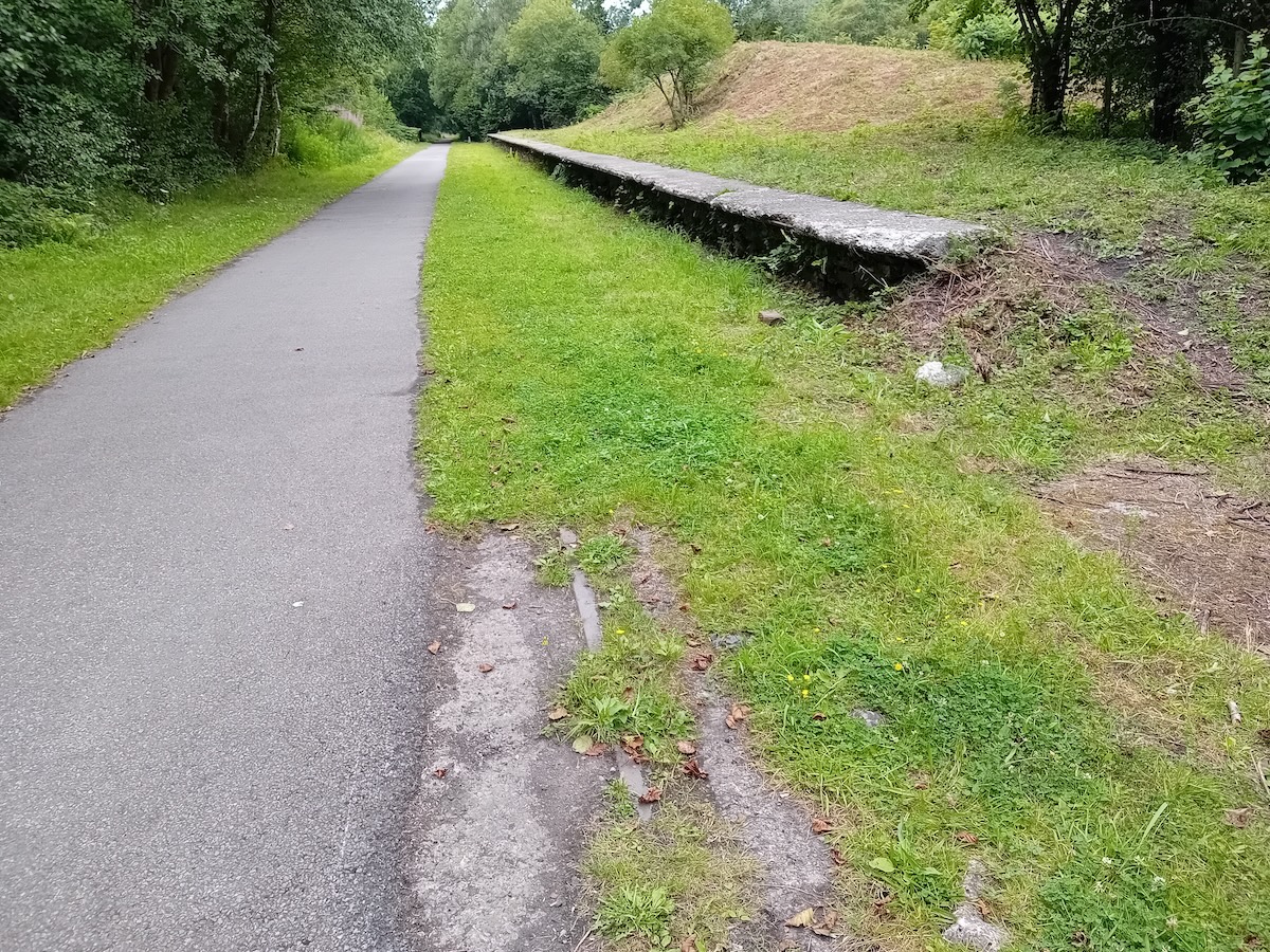
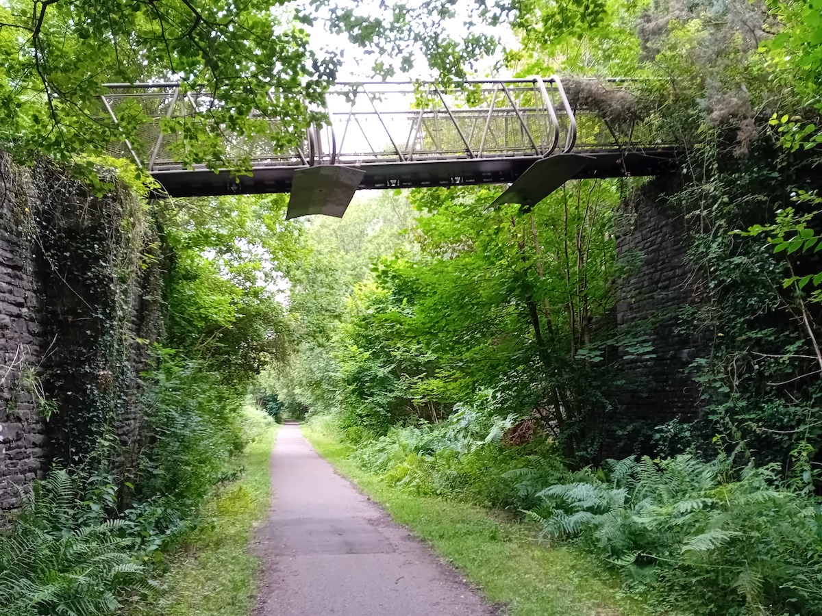
As we reflected on the dramatic change that had taken place in the area since its coal mining heyday, all walkers agreed it had been an enjoyable and interesting 3.5 mile walk down the valley, and we finished the day with a welcome drink in Bargoed before heading home.
Midland Railway, Pontardawe to Ystalyfera on Wednesday, 13th August
Our August walk was along the Swansea Vale Railway, which was formed in 1844 to develop a former tramroad but it was not until 1856 that the SVR applied for an Act of Parliament to extend northwards from Pontardawe to Ystalyfera and Ynyscedwyn, thus serving two major ironworks and various collieries, the extension opening to all traffic in 1861. The building of a line promoted by the Neath & Brecon Railway from Colbren on the N&B to Ynysygeinon on the SVR attracted the attention of the Midland Railway for a route to Swansea. The Midland absorbed the SVR in 1876 and in so doing inherited the unrestricted running rights the SVR had over the N&B system. Passenger trains were extended to Brynamman in 1868. The railway served the industries of the Swansea and Aman valleys for over a hundred years but as the industries of tinplate, iron and coal contracted, so did the railway. Passenger services ceased in 1950, and our route closed to all traffic in 1968.
On a day when we came armed with hats, sunscreen and plenty of fluids, seven walkers assembled in a layby off the A4067 just north of Pontardawe from which access to the footpath, once the track bed, was made. Two cars had been pre-positioned at the end of our walk in Ystalyfera to transport us back to our starting point. The walk was being led by John Miles and Keri Thomas, two experts on the Swansea Vale Railway who had written a book on the subject with Tudor Watkins. Keri had a copy of the book with him and used it to illustrate our walk and provide a historical commentary which we all found most interesting.
A short distance into our walk we came across the impressive 'tipping wall' of Old Waenycoed colliery which pre-dated the railway, opening in 1828. It was connected to the Swansea Canal via a tramway which crossed the River Tawe to coal tips. The colliery closed in 1876. At this point the railway was hemmed in between the river and the steep valley side, and nothing now remains of the siding which crossed the river to serve the Bryn tinplate works which was taken out of use in 1946.

A characteristic of the valley was small drift mines employing less than 100, but an exception was Tareni colliery, owned by the South Wales Primrose Coal Co. Ltd. This colliery opened in 1903, had two shafts, known as the Tareni and Gleison, and employment peaked during the early 1920s when close to 1,000 men worked there. There were three groups of sidings here on the west side of the running line as at this point the river moves away from the eastern side of the valley, giving sufficient space for the sidings to be built. Ynysygeinon Sidings signal box (1891 to 1965) was located on the east side of the running line, approximately in the middle of the siding complex which was used for both Tareni colliery traffic and other traffics. The pit was closed by the NCB in 1949 due to difficult geological conditions underground with the loss of 320 jobs.

About a mile beyond Ynysygeinon Sidings was Ynysygeinon Junction where the N&B line to Colbren Junction and Brecon climbed away to the east, the stone retaining wall being observed, whilst the SVR turned towards the west across the flood plain of the Tawe towards Ystalyfera. We noted what is believed to be the base of the up home signal of the Junction signal box and the foundation of the 1910 box which replaced the original structure. This box and its 20-lever frame was in use until 1967 when the line from Colbren Junction closed.
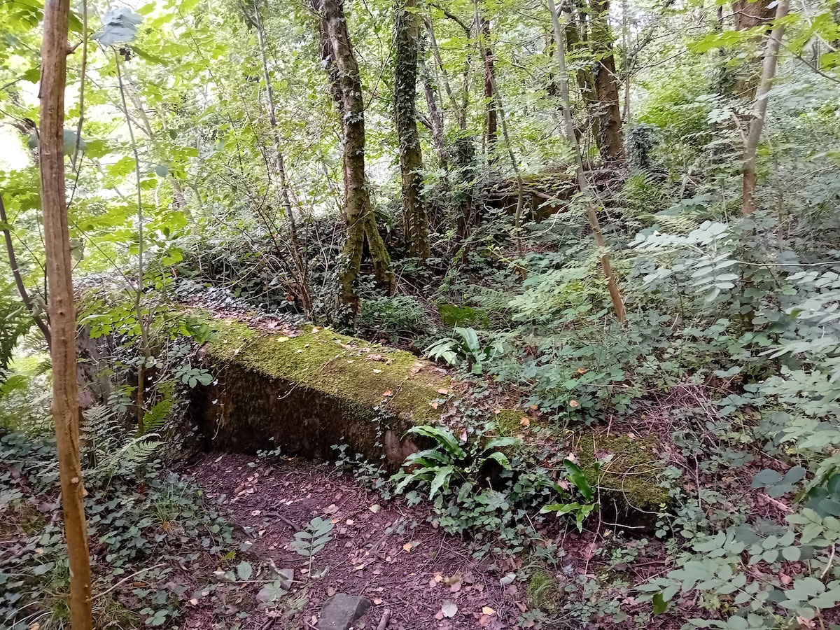

On the approach to Ystalyfera, the SVR crossed the River Tawe on a substantial bridge, latterly of stone but originally of wood, and sections of the stone abutments remain, inscribed 1884. The railway north towards Ystalyfera station is now under the A4067 but at the station site a retaining wall for the railway is still there, now serving the same purpose for the road. We had lunch in Asda supermarket across the roundabout from where our walk ended. This was the site of Ystalyfera iron & tinplate works of which there are some remains behind the supermarket. It was heartening to see that an information board charting the history of the Works has been erected in Asda's car park, but it's a shame the accompanying map is virtually indecipherable!

We reflected on an enjoyable walk whilst journeying back to the layby from which we started, and thanks are due to John and Keri for leading the walk and for their knowledgeable input. We now look forward to our final outing of the season when we gather at Llanfoist for a walk along a section of the LNWR's 'Heads of the Valleys' route to Gilwern on Friday 19th September which promises to be another interest-packed occasion, so fingers crossed for fine weather!
London & North Western Railway - Llanfoist to Gilwern on Friday, 19th September
Having had a very enjoyable walk along a section of the London & North Western Railway's 'Heads of the Valleys' route from Clydach to Brynmawr last September, we agreed to incorporate a second section, that from Llanfoist to Gilwern into the walks programme for 2025. The short section linking the two is now in private hands and although the track bed can't be walked, a detour is available to provide a continuous walk should this be desired.
Early transport developments in the area were focused on the Monmouthshire & Brecon Canal which attracted horse-worked tram roads and that between Nantyglo Ironworks and the canal wharf at Govilon opened in 1822 and ran via Brynmawr and Clydach Gorge. The Act for the Merthyr, Tradegar & Abergavenny Railway was obtained in 1859 and the line opened between Abergavenny and Brynmawr in 1862. The Newport, Abergavenny & Hereford Railway, opened in 1854, had become part of the West Midland Railway in 1860 and made a bid to lease the MT&AR but were outbid by the giant L&NWR whose directors were keen to gain a foothold in South Wales.
The route lost its freight trains, both through and local, in 1954, the severe gradients and restricted payloads making them uneconomic to operate, but contrary to normal practice, passenger services soldiered on being withdrawn during the first week of 1958.
The section walked was at the eastern and lowest end of the MT&AR but ascended steeply on gradients as severe as 1 in 34 near Govilon. It had originally been my intention to walk down the gradient from Gilwern, but the station site is at the top of a very steep climb from the village along narrow roads with very limited on-road parking and so the adopted option was to walk against the gradient from Llanfoist and then drop down to the village at Gilwern for the bus back.

Seven walkers assembled at the car park at Llanfoist for our final walk of the season on 19th September in pleasant walking conditions - overcast but dry - in stark contrast to the very wet weather experienced over the preceding few days. Our route was less industrialised and had fewer heavy engineering features than that walked last summer between Clydach and Brynmawr, but the views from it were impressive and there were several attractive and well-preserved bridge structures to observe together with surviving station buildings at Govilon, now a private residence, and station platforms at Gilwern.
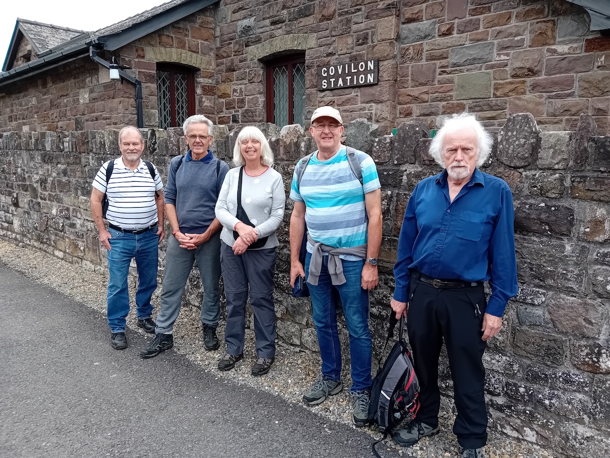
The canal wharf at Govilon remains a busy location today, but the 'hustle and bustle' of bulk commodities such as coal, iron and limestone being transhipped has given way to pleasure craft and the leisure pursuits of the boating fraternity. The rail siding here was removed in 1953, a year before freight services ceased over the route. The signal box, level crossing and coal yard at Govilon have long gone, but the stationmaster's house remains as does the substantial stone-built station buildings, now enlarged to form part of an attractive dwelling.
We left the former track bed at Govilon to take a short walk along the canal to the Bridgend Inn where lunch was enjoyed, and a welcome break provided to rest our legs and take on food and drink to sustain us on the climb to Gilwern. Continuing our walk, we soon passed the site of Weldon Ironworks, which was rail connected from 1884 until 1940, before crossing the 50-yard-long Weldon Viaduct and onwards through a pleasantly rural landscape and a tree lined avenue which now obscures the fine views once enjoyed by train travellers.
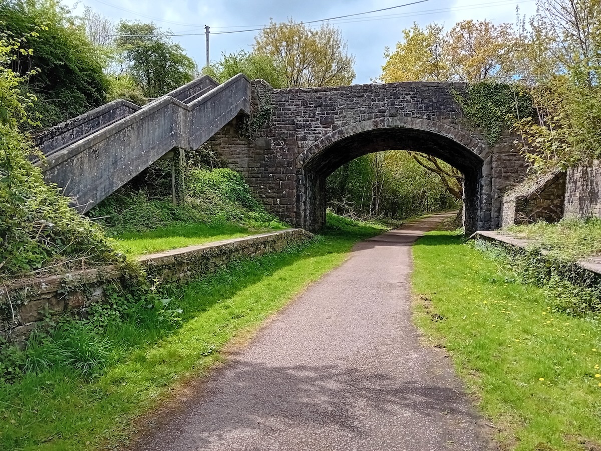
On the approach to Gilwern we passed the site of Gilwern stone quarry where a signal box was in use from 1890 to 1921. At Gilwern, the platforms remain as does a set of concrete steps which linked the road overbridge to the down platform. As the station buildings were of timber construction, nothing now remains but given the tranquility of the present site, it was hard to visualise that there had once been gasping locomotives on the 1 in 38 climb from Govilon, a rise of about 150 feet in under 2 miles.

Having reached the site of Gilwern station we descended very steeply to the village half-a-mile below. As the Stagecoach bus service from Gilwern back to our start point at Llanfoist was hourly, we were keen to present ourselves at the post office stop for the bus timed to depart at 16.10. Arriving with about 10 minutes to spare, we waited and waited and waited for the service which eventually arrived 35 minutes late! A minor blip on an otherwise enjoyable day and we all agreed that the walk of about 4 miles in total had been a fitting end to our programme of walks for 2025.
In anticipation of next summer, Mark Hambly has volunteered to organise a walk in North Wales which he will recce soon, and I'd be happy to lead a couple of walks in South Wales, or maybe one in Mid Wales should interest be shown, to complete the programme. If members would like to suggest a walk, then I'd very much like to hear from you.
Many thanks to Keith Dumelow.